
Winter Storm update
Good evening.
THERE IS A WINTER WEATHER ADVISORY ISSUED FOR THE COAST AND MIDDLESEX AND NEW LONDON COUNTIES.
As we brace for whatever the storm brings our way, please remember that we have a town wide parking ban in effect from 8 PM tonight until 8 AM Sunday morning, so that snowplows can clear the roads and put down salt and sand as needed. The municipal parking lot located in back of the library is available for off street parking.
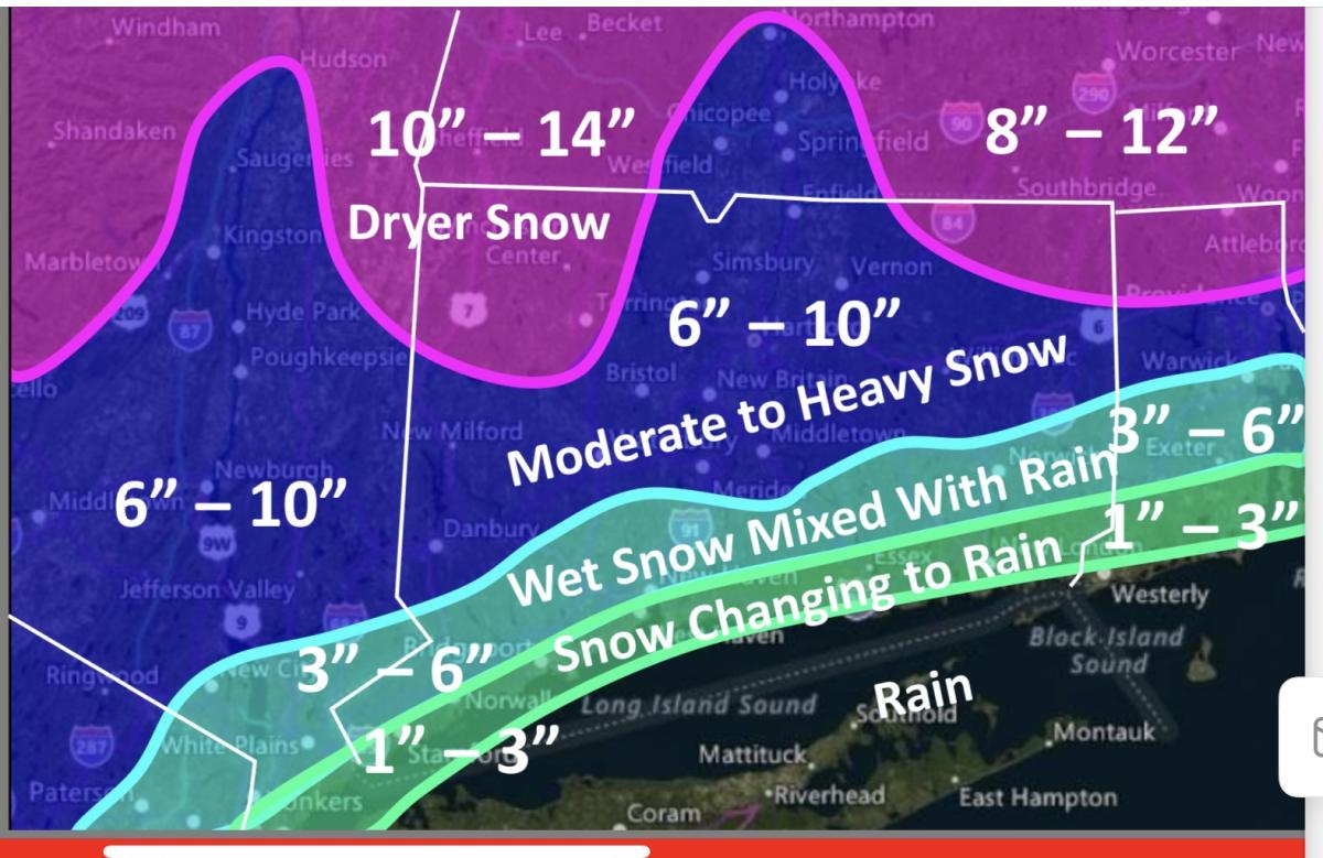
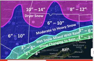
The latest weather forecast has Deep River close to the delineation line between a rain snow mix with 1-3 inch accumulation and a snow accumulation of 3-6 inches.
A period of very heavy snow may occur between 10:00 PM – 2:00 AM with snowfall rates between 1.0” – 2.0” inches per hour across central Connecticut. The snow intensity is expected to taper down to light snow as a dry slot moves into the state towards daybreak. A rain/snow line is expected to move from the coast at midnight into southeastern CT by 4:00 AM which will cut down on snow accumulations in Middlesex and New London counties.
Since temperatures will stay in the low 30s, look for freezing, icy conditions on sidewalks and roads. Wind gust up to 35 miles an hour along. The coast are possible.
Please be careful. Stay off the roads if you can.